
Features Sabretooth
Sabretooth is a sophisticated, simple, powerful, modular GIS framework for mobile and stationary use.* NOTE *: This is the mobile app for Sabretooth.
In order to use them, a Sabretooth infrastructure must be available.
Please continue reading below for more detailed information or at https://sabretooth.ch/-------------We ask you to report bugs via [email protected] instead of giving a bad rating.-------------With Sabretooth you can:* Easily and quickly create data tables with attributes and geometries (points, lines and surfaces)* capture data directly online with the mobile device* Create a WMS (Web Map Service) from the defined data tables and integrate it into your own GIS applications.* Enter and edit data offline in the field DataThis is the mobile app for Sabretooth.
It can NOT be used without a sabretooth backend.
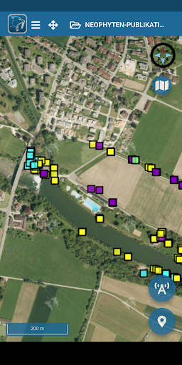
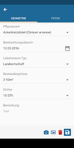
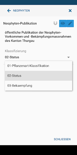
Further information and demo systems can be found at https://demo.sabretooth.ch/The aim of the Sabretooth app and infrastructure is to create simple geo-applications without GIS knowledge in a short time and already begin with the collection / editing of geographically linked data.Key features:* Application stack consisting of: * mobile apps for Android and iOS (frontend) * Web application for managing and creating geo-topics, data and users * PostGIS database based on PostgreSQL * Mapserver for the WMS release* Define geometry topics with their own attribute fields / types* Support of point, line and surface geometries* Support of multiple sub-records per geometry* Definition of projects with several topics* Create Mapserver Mapfiles / WMS services from templates* WMS styling by classifying the data using attribute columns* Sophisticated authorization concept* Plugin infrastructure for implementing custom hooks / functionalities* based on independent open source components and frameworks* User data is stored in specially created tables and can be edited / read using database tools* REST / JSON backend* App is offline usable
Weather Features
Get accurate weather forecasts and real-time updates.
Food & Dining
Discover recipes and order food from your favorite restaurants.
Shopping Features
Shop online and find the best deals.
See the Sabretooth in Action
Get the App Today
Available for Android 8.0 and above